Мой профиль

язык курса
длительность курса
понадобится для освоения
для зачета в своем вузе
Welcome to the course “Seismic tomography”.
We will speak about the use of seismic tomography and its mathematical base, we’ll learn about earthquakes and find out how they start, also we’ll conduct some experiments and go on an expedition to Kamchatka.
By the end of the course you’ll know the basics of seismology and how to use the technical instruments and programs in practice. So it doesn't matter what level you’re on. Complex things are explained with simple and accessible language. Geophysists, mathematicians, geologists, geochemists, petrologists, engineers and everyone interested will find a lot of new information and get the access to the author's research methods and scientific algorithms that are used by seismologists all over the world.
The adventure begins!
The course consists of 10 modules (10 weeks).
Weekly activities include:
· watching videolectures;
· answering ungraded quiz questions to make sure that the student understands the lecture material;
· reading additional materials;
· practicing with technical instruments and programs;
· completing weekly graded quizzes which contribute to the final grade.
Also, the students have to pass the final test at the end of the course to evaluate their overall knowledge of the course material.
Seismic imaging of the Earth Laboratory
LOTOS, code for non-linear local earthquake tomographic inversion
http://www.ivan-art.com/science/LOTOS/
Ivan Koulakov’s personal page: algorithms and publications
Module 1. Tomography as a tool to look inside the Earth
What is this course about?
What can we see inside a little stone?
Doing tomography with a hammer and explosions
Earthquakes show us the Earth deep inside
Module 2. History of measuring earthquakes
How did people learn to measure earthquakes?
First attempts to look deep into the Earth
Body waves. How do they propagate inside the Earth?
Surface waves
Module 3. Look inside a volcano
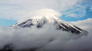
Land of Fire — Kamchatka
Installing seismic stations on volcanoes. Almost a Hollywood adventure
KISS of the Kamchatkan volcanoes
Tomogram a few days before a volcano explosion (case of Bezymianny volcano in Kamchatka)
Huge steam boiler within Gorely volcano
Three independent views on the magma system of Avacha volcano
Module 4. Tomography: the must-know things
Too many unknowns, too little information: is the problem unsolvable?
Simplify – linearize – discretize
Miraculous inversion: solving millions of equations on a simple PC
Module 5. Basic Tomo
Start working with Basic Tomo
BASIC TOMO. Recover the smiling face
Playing tomography chess
Module 6. PROFIT code
Ray tracing: shoot or bend?
PROFIT code: basic principles
PROFIT code: basic principle. Software + dataset
PROFIT code: start working with data
PROFIT code: process our experimental data
Go to the field with a big hammer to make a real seismic experiment
Module 7. Doing tomography with natural sources
Earthquakes: trouble for people, but precise tool for scientists to study the Earth. Mechanism - rock fracture
How to localize earthquakes?
Module 8. LOTOS
LOTOS: tool to explore 3D structures and localize earthquakes
LOTOS: Basic principles
LOTOS: look inside a supervolcano
LOTOS: look at Stromboli
Module 9. Surface wave tomography
Noise is another seismic source
Surface wave tomography: two-step workflow
Problem of testing: how far our images from the absolute truth?
Module 10. Conclusion
The students who completed the course successfully, will acquire the following knowledge and skills:
knowing the history of seismic tomography;
understanding the basics of seismology;
understanding the dynamics of earthquakes: how do they start and develop;
using the instruments and software (BASIC TOMO, PROFIT code, LOTOS) in practice.
ПК-1. Способность использовать знания в области геологии, геофизики, геохимии, гидрогеологии и инженерной геологии, геологии и геохимии горючих ископаемых, экологической геологии для решения научноисследовательских задач (в соответствии с направленностью (профилем) подготовки).
язык курса
длительность курса
понадобится для освоения
для зачета в своем вузе
The cost is 3600 rubles. You can pay for training in the "My courses" section in your personal account.

Doctor of Sciences (Geology and Mineralogy), Corresponding member of RAS
Должность: Senior Lecturer of the Department of Geophysics GGF NSU